


This is seriously cool stuff, and it’s the kind of project that makes you appreciate how far mapping technology has come.
Google, in partnership with Ford, has just dropped a collection of new Street View imagery, but this isn’t your typical suburban streetscape. This time, they’ve gone way off-road, conquering the legendary TransAmerica Trail (TAT).
Capturing The Uncapturable: 5,900 Miles of Off-Road Adventure
The TransAmerica Trail is a behemoth, a continuous network of unpaved and dirt roads that stretches over 5,900 miles across the United States. It’s the ultimate proving ground for off-roaders and a bucket-list journey that winds through some truly remote and wild country. It’s been notoriously difficult to map, relying on enthusiast-created guides and GPX files.
This whole thing started as a massive collaborative effort to bring this epic route to a mainstream audience. The goal was simple, yet daunting: capture the entire trail and integrate it into Google Maps Street View for the first time ever. It’s about accessibility and letting people explore the remote, rocky paths and deep wilderness areas from their comfy couch.
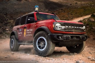
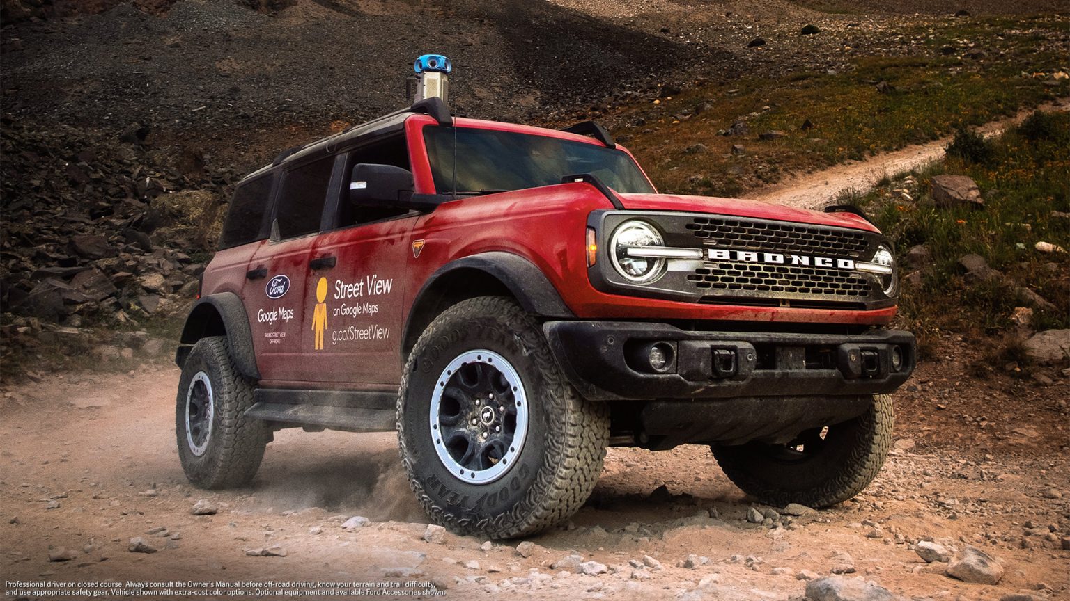
The Weapon of Choice: Ford Bronco
You can’t just slap a camera on a sedan and expect to traverse 5,900 miles of unforgiving terrain. This job needed something built for the rough stuff, and that’s where the Ford Bronco came in. Specifically, they used a Bronco Badlands model, which is perfectly specced for this kind of gruelling expedition.
– Advertisement –
The Bronco’s capability was key, navigating everything from deep sand and rocky passes to muddy trails and creek crossings. The vehicle was equipped with Ford’s HOSS (High-Performance Off-Road Stability Suspension) System, which is crucial for maintaining control and stability over extreme surfaces.
The sheer ruggedness of the Bronco allowed the Google team to focus on the imagery collection, rather than worrying about getting stranded in the middle of nowhere.
The journey wasn’t a solo effort for the Bronco; it was supported by a convoy that included a Ford Ranger Lariat and an Expedition Tremor.
This support crew was essential for carrying all the necessary gear, provisions, and the rest of the team required for such a long and demanding expedition across the continent. Over 32 days, the small fleet trekked from the coast of Oregon to the coast of North Carolina, proving the capability of the new Ford off-road lineup in the process.
Tech Specs: Google’s New Street View Camera
The other half of this powerful partnership was the technology itself, specifically Google Maps’ newest Street View camera system. You’d think an off-road route like this would require some huge, custom-built rig, but that’s not really the Google way anymore. Their new system is designed to be more flexible, and most importantly, lighter and faster to deploy.
New Camera System
The camera unit used for the TAT capture is much more compact and lighter than previous versions. It weighs less than 7 kilograms, allowing it to be mounted quickly and securely to any roof rack, including those on off-road vehicles like the Ford Bronco. This portability meant the team could efficiently tackle the constantly changing terrain without heavy, restrictive hardware slowing them down.
Virtual Scouting
Overlanders can now virtually ‘scout’ the entire trail before they even leave home. You can preview upcoming sections, assess the difficulty of a specific rocky climb or water crossing, and gauge the general state of the dirt roads. This makes trip planning exponentially more accurate and safer for all experience levels, from first-timers to seasoned adventurers.
Accessibility and Confidence
By bringing the TAT onto Street View, Google is democratising access to one of the world’s great overland routes. It gives drivers of all experience levels the confidence to plan a trip, knowing they can review the environment beforehand. This removes much of the guesswork and anxiety associated with tackling such a remote and extensive route.
“We’re proud that the imagery captured on our adventure is now a tool that can help drivers of all experience levels preview trails and feel more confident planning off-road trips of their own.”
Ford spokesperson
Street View is going off-road. Way off-road. ⛰️
We partnered with @Ford to put our Street View technology to the ultimate test: capturing all 5,900 miles of the legendary TransAmerica Trail, bringing it to Google Maps for the first time. The dirt roads, rocky paths, and remote… pic.twitter.com/af2H3r6MP1
— Google Maps (@googlemaps) October 27, 2025
